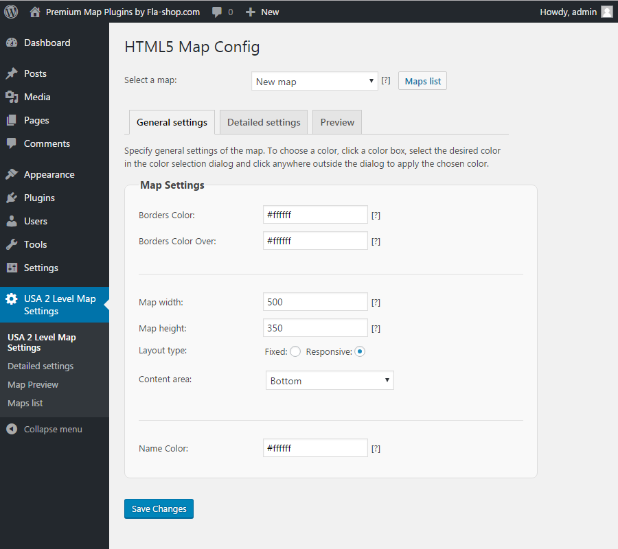
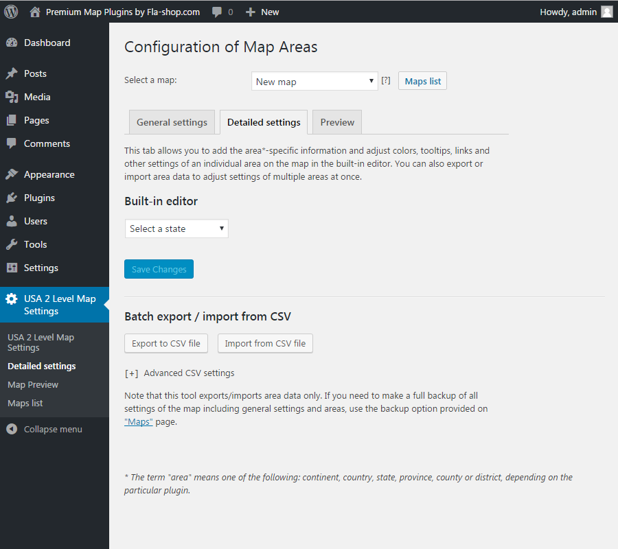
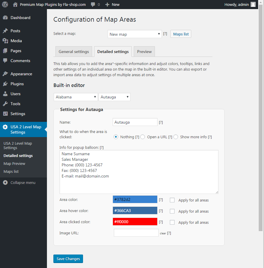
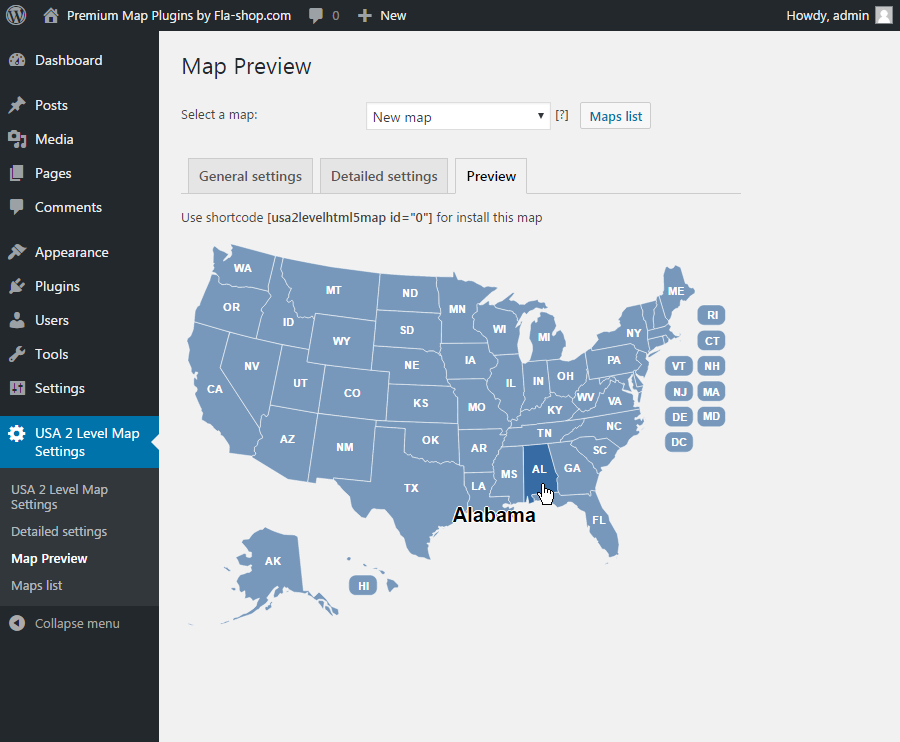
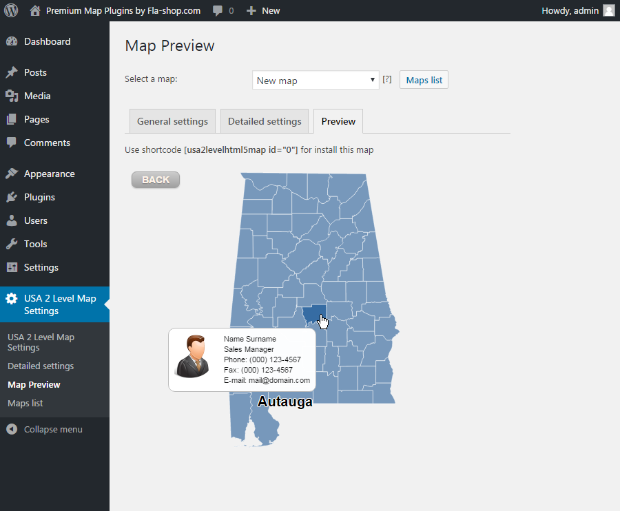
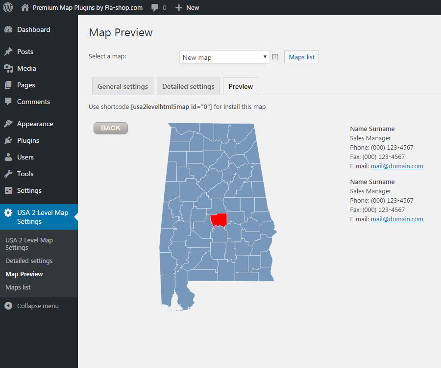
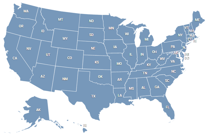
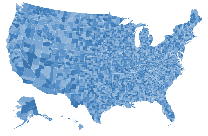
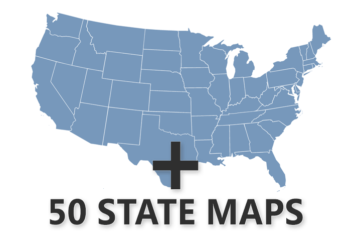
Interactive JavaScript Maps
United States and Counties Interactive Map for WordPress
Interactive HTML5 US Map premium plugin for WordPress featuring state and county selection, color adjustments, custom landing pages and popup windows.

Features of Premium version
- Drill-down HTML5 US map
- Works on iPad, iPhone, Android. No Flash
- Static or responsive size
- Adjustable tooltip popups
- Additional information can be displayed on below or right side of the map
- Adjustable colors and links
- Builds into any WordPress page or post with a simple shortcode
- Export/import county data via CSV (Excel spreadsheets)
- NEW! Visual editor for adding points
HTML5 Drill-down US Map for WP. Single License |
![]() |
$299 (one-time fee) |
BUY NOW! |
Overview
Put an interactive hiqh-quality HTML5 US map to your WordPress-powered blog without any efforts!
Whenever you need to give your visitors a simple yet effective way to navigate through regional sections of your blog, or if you want to provide some geography-related information to your readers, Fla-shop.com interactive HTML5 US map plugin is a one-stop solution.
This plugin allows you to display eye-catching detailed US map by adding a simple short-code into the page or a single post of your WordPress-powered website. Rich customization capabilities allow you to change the whole map in accordance with your preferences.
DOWNLOAD FREE DEMO
Screenshots


Installation
- Use the Plugins -> Add new -> Upload menu and select plugin's zip file to open.
- Wait for the upload to complete and activate the plugin.
- After that, insert the map short code into the text of a page or a post where you want the map to be. Short codes can be viewed on tab "Maps".
Related articles
Also available
- Interactive U.S. map with clickable states
Products
Select the map variant you need.
WordPress Compatible Maps
» United States map for WP
» US County map for WP
» US & Canada map for WP
» Congressional District map for WP
» Bundle: US + All States
» Bundle: US + Canada
» Drill-down US Map for WP
Individual state maps for WP
Any CMS Compatible Maps
» United States HTML map
» U.S. County HTML map
» US & Canada HTML map
» Bundle: US + All States
» Drill-down US Map
WordPress Compatible Maps
» United States map for WP
» US County map for WP
» US & Canada map for WP
» Congressional District map for WP
» Bundle: US + All States
» Bundle: US + Canada
» Drill-down US Map for WP
Individual state maps for WP
»
Any CMS Compatible Maps
» United States HTML map
» U.S. County HTML map
» US & Canada HTML map
» Bundle: US + All States
» Drill-down US Map
Live Examples
See how US maps looks on real websites of our clients.
http://asthvi.org/
http://brundagebone.com/
http://uscollegeindex.com/
http://thestoneresource.com/
http://sti-co.com/
http://servingalcohol.com/
http://passporttitle.com/
http://mcc.builders/
http://letsgosolar.com/
http://klein-usa.com/
http://foodhandlersolutions.com/
More examples
http://asthvi.org/
http://brundagebone.com/
http://uscollegeindex.com/
http://thestoneresource.com/
http://sti-co.com/
http://servingalcohol.com/
http://passporttitle.com/
http://mcc.builders/
http://letsgosolar.com/
http://klein-usa.com/
http://foodhandlersolutions.com/
More examples
Custom Development
Fine tune the map for the best fit and custom capabilities not available in standard maps.
More info
More info