India Map

Select colors and click states to fill map

Main color
Hover color

Click on the map or choose from the list to add a link or text to a tooltip.

Double-click to add a point. Click and hold to drag. Double-click to edit.

How to embed an interactive map on a website
Select which platform your website runs on
1 Download a plugin
  • Free for personal and commercial websites
  • Attribution required
  • Compatible with any WP theme and page builder
2 Download map settings
3 How to install
  • Choose in WordPress: “Plugins” - “Add new” - “Upload”, and select the plugin’s ZIP file
  • On the “Maps” page in the plugin settings, click “Import” and select the JSON file with the settings
4 Support
  • Guidelines and a contact form are available on the Support page


1 Download a JS map
  • Free for personal and commercial websites
  • Attribution required
  • Compatible with most popular CMS (Squarespace, Shopify, Joomla!, Drupal, etc.)
2 How to install
  • The downloaded ZIP file contains the JS/CSS files that are required to upload to the website.
  • Installation instructions for different CMS can be found on the Support page.


Export the map as an image

Export the map in .PNG format for use in presentations, etc.

Import

Import JSON or “settings.js” file

To edit another map, select from the list
Boost your website's efficiency with our interactive map of India. Available for both WordPress and HTML sites through a plugin and JavaScript. It's easy to install, and intuitive to use. Try it today!

Features of interactive map of India

WordPress
HTML5

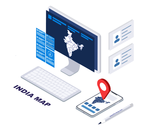
Our WordPress plugin version of the Interactive Map of India is simple and functional. The easy-to-use admin panel offers a fully visual interface for map configuration – no coding required. Enjoy benefits like:

Unlimited number of maps
An unlimited number of maps with different settings
Color picker
Apply adjustable colors to states and markers
Tooltip on hover
Hover to get tooltips
Click events
Customizable click actions — links, pop-ups, and more
Contact info
Display content next to the map
Batch settings
Individual and batch settings for states
Grouping of states
Group states into regions
Marker
Map points and markers
Fonts
Customizable fonts – you choose the color, size, and font-family
Support for CSV spreadsheets
Export/import settings via CSV tables
Integration with plugins
Compatible with Popup Builder, TablePress, and others
Shortcode
Insert via shortcode into a page or post

The HTML5 version of the map is a set of JavaScript and CSS files used to embed the map into CMS websites like Joomla, Drupal, and Squarespace. You don’t need advanced coding knowledge, but basic HTML is sufficient. Features include:

SVG map
SVG-based map of India with clickable states
Mobile-friendly
Adaptive map sizing
Editing settings
Edit settings in a static file/visual editor
CSS
Use CSS to design tooltips
HTML
Use HTML within the tooltips
Color picker
Colors for states, points, and other things
Pop-up balloon with contents
Hovering to get tooltips over images and text
Opening links
Click on a state to open a link
Marker
Adding points in the visual editor
JavaScript API
Using JavaScript API for event tracking
Dynamic settings
Dynamically generating map settings
Keyless
No need for a Google API key

Map Usage Applications

Sales Regions Map
Display your representatives’ contact information by state or region
Data Visualization & Infographics
Create a heatmap or intensity map, or show popular rates, demographic information, etc.
Map with clickable states
Add links to the relevant sections or pages of the site

Frequently Asked Questions

What can I use the online map editor for?

With this tool, you can easily customize an India map for your specific needs, whether it's for print or digital media. You can create interactive maps for your website or blog or design infographics for presentations. If you need more advanced customization options, you can also download the India map plugin, which offers additional features.

What is the difference between the WordPress plugin and the HTML5 version of the map?

Both the WordPress plugin and the HTML5 version of the map are essentially the same, but the WordPress plugin comes with a user-friendly visual interface for managing map settings. You don't need any coding skills to use the plugin. On the other hand, the HTML5 version is designed for use with Joomla, Drupal, plain HTML sites, and so on, and it requires some basic HTML knowledge.

Are there any maps available other than India?

Absolutely! We offer a variety of maps including the World, United States, Canada, Australia, Brazil, Ireland, the Netherlands, and many other countries.