Category: Plugin reviews
 5 Features of the US Map for WordPress Plugin
Feb 14, 2022
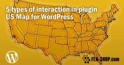
In this post, we'll review some real life examples of using an interactive map: displaying content near the map after clicking on a section, displaying tooltips, opening hyperlinks, showing lightbox popups, and showcasing API by launching JavaScript.

 Bulk Edit feature of USA Map plugin for WP
Mar 06, 2023
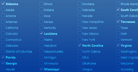
If you are running a business website on WordPress, and you have a wide network in the USA, then you must consider using an interactive USA Map plugin to provide all the information to your visitors. Recently, a new feature has been introduced in the plugin that will allow you to do bulk editing for multiple states at a time.
 Review of the US Map for WP. Part 5: Points settings
Nov 22, 2022
Each interactive map from Fla-shop.com has the capability to add the points to the map. What is a point? The point is the special place on the map that can be provided with any necessary information. Do you want to know more?
 Review of the US Map for WP. Part 4: Groups settings
Nov 22, 2022
First of all, Grouping is a powerful feature of the US interactive map WordPress plugin from Fla-shop.com. As follows, it allows you to set the same parameters to several states grouped into one or more groups. For example, this feature is useful when you want to display any statistical data on the map or to show the departments structure of your company.
 Review of the US Map for WP. Part 3: Detailed settings
Nov 22, 2022
Firstly, the "Detailed settings" section allows adding the specific information for each US state. Secondly, you can customize the state color and other settings there.
 Review of the US Map for WP. Part 2: General Settings
Nov 22, 2022
The "General settings" tab allows the website administrator to set up the main settings for WordPress interactive map, such as map name, width, zooming, etc. So, this article is a comprehensive review of each general map setting.
 Review of the US Map for WP. Part 1: Maps list. Backup of settings.
Nov 22, 2022
For one thing, this section allows creating and deleting maps, making backup, and import/export map settings.
 WordPress US Map Plugin: Complete Overview
Jul 28, 2026
First of all, this article opens a series of articles devoted to a comprehensive review of the US map plugin for WordPress options and possibilities. Each article will cover one option block.
 Try-for-free Customizable US Map
Nov 24, 2022
Usually, buyers of standalone software have an opportunity to download a demo/trial version to take measures of the product. Nevertheless, our customers are not an exception and we always offer them the downloading of the demo version to estimate our product.